What You Need To Know About BC Wildfires
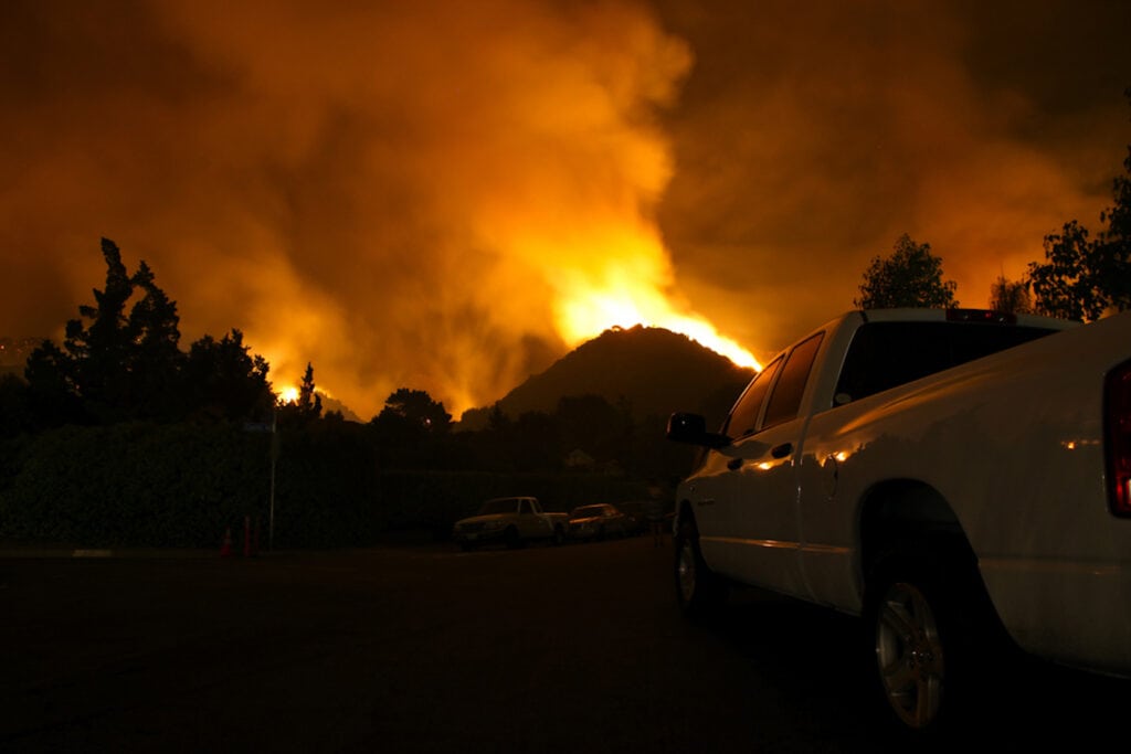
If you’re planning a trip to British Columbia this year, you might want to change your plans. There are currently a record number of wildfires in the province. The province’s 382 wildfires include out-of-control wildfires in the South and Central regions. These fires are burning dangerously close to some major cities.
BC is in a state of emergency
The situation has forced the government to declare a state of emergency. The state of emergency includes a ban on booking temporary accommodations (including campgrounds and RV parks). The ban is in place to help provide accommodations for people evacuated from their homes due to the wildfires. Considering that there are currently 35,000 people who have had to evacuate their homes due to wildfires, it’s easy to see the reasoning behind the ban.
Which cities are affected by the bans?
Unfortunately, the cities affected by the non-essential accommodations ban happen to be some of BC’s most popular resort destinations. The affected cities are:
- Kelowna-West Kelowna
- Kamloops
- Oliver
- Osoyoos
- Penticton
- Vernon
The province is also asking everyone to avoid non-essential travel in BC’s central interior and southeast to help keep roadways clear for emergency response operations, including further evacuations. With that being said, the following wildfire-related restrictions and closures on major BC highways are likely to affect travel to many areas of the province.
- Highway 1 (Trans Canada)
- Highway 3
- Highway 5
- Highway 5A
- Highway 97
It’s worth noting that many other highways and roads in BC are currently closed due to wildfire activity. However, as with all natural events, things can change rapidly. With that being said, highways that were open one day can be closed the next. Aside from the non-essential travel restrictions and highway closures, it’s a good idea to avoid all routes that involve southern BC right now due to wildfire smoke.
Wildfire smoke throughout Southern BC
Aside from the non-essential travel restrictions and highway closures, dense smoke might make you want to avoid all routes that involve southern BC right now. That’s because smoke from the BC wildfires is dense in all areas of southern BC. With that being said, wildfire smoke presents a very real health hazard, and it’s particularly bad for those people with breathing difficulties or other health conditions.
As of this writing, the air quality continues to be rated as moderate to high risk in every area of southern BC, including all of Vancouver Island.
Traveling to Alaska
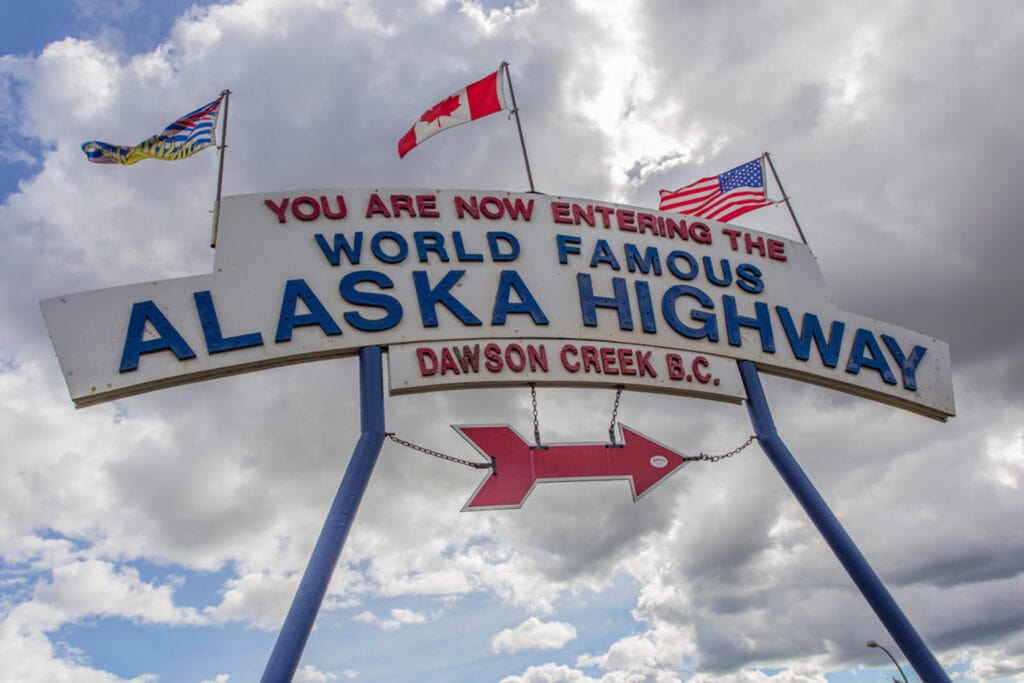
Are you traveling to Alaska, or making a return trip from there? If so, you’ll probably want to avoid southern BC for now due to the dense smoke and highway closures. Fortunately, you can avoid the west access route that traverses southern BC.
In addition to the West access route, there’s another major route that goes through scenic Alberta. The East Access Route for the Alcan Highway takes you from Montana to Dawson Creek, BC. LAlberta has many regional attractions and you’ll find fantastic RV parks and campgrounds all along the way.
Use RV LIFE Trip Wizard to avoid wildfires
RV LIFE Trip Wizard has a lot of great features. One of them is the Weather Layer, which can be used to locate wildfires along your route. Another cool feature of the app is that it’s really easy to use. That being said, here’s exactly what you’ll need to do to use this feature:
- Open the RV LIFE Trip Planner at http://tripwizard.rvlife.com and log in to your account.
- Open your trip or input your route.
- Select “Map Settings” in the menu bar
- Scroll down and select “Weather Layer”
- Toggle “Wildfires” on.
Using the Weather layer on the Trip Planner allows you to easily avoid routes that have active wildfires.
This post does not tell the whole story. Weather and fire conditions are changing daily. Check DriveBC https://drivebc.ca/mobile/map/index.html# to see a current map of conditions.
Kelowna received rain August 22-23 and many restrictions have been lifted in the Okanagan valley.
Also check BC Wildfire Service https://wildfiresituation.nrs.gov.bc.ca/map
Thanks for the update. Until a week ago I was planning a trip exactly to the places you mentioned in the article. Since that trip is off I was planning to go to Banff and Jasper. What are the fire and smoke conditions there like?
As an RV owner and user, and BC resident, I would suggest those planning to traverse British Columbia for any purpose, to make use of the official government sites to obtain the most current information on the wildfires, road and highway conditions, and related accommodation constraints. Web sites with .gov in the URL, such as those below, are trustworthy. Others, operated by a government body such as a municipality or city should have current information, making it more trustworthy than independent sites.
Examples of sites to trust:
https://www.emergencyinfobc.gov.bc.ca/current-wildfire-information-2023/
https://www2.gov.bc.ca/gov/content/safety/wildfire-status
https://drivebc.ca/mobile/events/index.html